 @kexpmusicbot@mastodonapp.uk
2025-07-18 00:30:17
🇺🇦 #NowPlaying on KEXP's #DriveTime
Flying Mojito Bros:
🎵 Catch Me
#FlyingMojitoBros
https://flyingmojitobros.bandcamp.com/album/catch-me-ft-will-worden
https://open.spotify.com/track/7ajCawrPZVPSdxgQ8GlRhT
 @johl@mastodon.xyz
2025-09-17 15:09:29
The Cat’s Maew: Thai Treatise on Auspicious Felines (19th Century)
https://publicdomainreview.org/collection/tamra-maew/?utm_source=newsletter
 @arXiv_astrophHE_bot@mastoxiv.page
2025-07-14 09:43:42
Observation of the Shadows of the Moon and Sun Using the Pierre Auger Observatory at an Average Energy of $7\times10^{17}\,$eV
Katar\'ina \v{S}imkov\'a (for the Pierre Auger Collaboration)
https://arxiv.org/abs/2507.08582

 @arXiv_mathCO_bot@mastoxiv.page
2025-08-15 09:14:22
The maximum number of triangles in $K_{1,s,t}$-free graphs
Asier Calbet, Ritesh Goenka
https://arxiv.org/abs/2508.10611 https://arxiv.org/pdf/2508.10611

 @Techmeme@techhub.social
2025-07-09 04:25:51
Sources: Apple is in talks to acquire US streaming rights for Formula 1 following the success of F1 the Movie, which has grossed ~$300M at the box office (Financial Times)
https://www.ft.com/content/ef6bbb12-1ef5-4fc7-bff5-77d000c36bff
 @arXiv_csLG_bot@mastoxiv.page
2025-09-12 09:30:59
A Scoping Review of Machine Learning Applications in Power System Protection and Disturbance Management
Julian Oelhaf, Georg Kordowich, Mehran Pashaei, Christian Bergler, Andreas Maier, Johann J\"ager, Siming Bayer
https://arxiv.org/abs/2509.09053

 @Mediagazer@mstdn.social
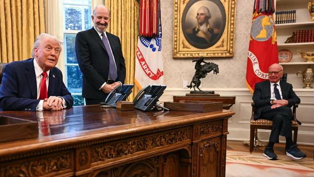
2025-08-05 08:05:41
Court filing: Trump and Rupert Murdoch agree to postpone Murdoch's deposition in the Epstein letter libel suit until after a ruling on the WSJ's dismissal case (Rebecca Falconer/Axios)
https://www.axios.com/2025/08/05/trump-murdoch-lawsuit-epst…
 @cowboys@darktundra.xyz
2025-09-03 13:33:44
Luepke, Cowboys agree to terms on contract extension https://www.dallascowboys.com/news/luepke-cowboys-agree-to-terms-on-contract-extension
 @NFL@darktundra.xyz
2025-07-01 15:45:01
Waller unretiring as Dolphins trade for tight end https://www.espn.com/nfl/story/_/id/45631064/darren-waller-unretiring-dolphins-acquire-te-trade
@Mediagazer@mstdn.social2025-07-09 04:25:42
Sources: Apple is in talks to acquire US streaming rights for Formula 1 following the success of F1 the Movie, which has grossed ~$300M at the box office (Financial Times)
https://www.ft.com/content/ef6bbb12-1ef5-4fc7-bff5-77d000c36bff