 @Sustainable2050@mastodon.energy
2026-02-07 22:11:01
Last Wednesday, the village of Grazalema (southern Spain, 900 m altitude) received 577 mm of rain in one day: the second highest ever recorded in Spain, only behind the deadly downpour in the Valencia region of 29 October 2024. https://malagaldia.es/2026/0…
 @inthehands@hachyderm.io
2026-03-08 18:09:14
For what it’s worth, we have a system in MN that’s not too far from this: if you’re not already registered to vote, you can show up on election day with one from a limited set of approved gov-issued photo IDs, •or• proof of residence such as a utility bill plus a registered neighbor who will legally vouch for you.
The result? We have some of the highest voter turnout rates in the country (often •the• highest), and just •vanishingly• small rates of fraudulent / illegal votes (because the consequences for such votes are just as severe as ever, not changed at all by the ease of same-day registration).
 @socallinuxexpo@social.linux.pizza
2025-12-09 13:32:01
Thank you, NetKnights, for being a Registration Sponsor and Silver Sponsor of SCaLE 23x! Your dedication to security and open-source empowers our community. We can't wait to see you in Pasadena! 🌐 Learn more: https://netknights.it/


 @brichapman@mastodon.social
2026-01-08 01:30:24
Beyond Resistance — #climate…

 @matthiasott@mastodon.social
2026-02-09 00:30:04
✍️ New article: Webspace Invaders
👾👾👾👾👾👾👾👾👾👾👾👾
https://matthiasott.com/articles/webspace-invaders

 @netzschleuder@social.skewed.de
2026-03-08 11:00:05
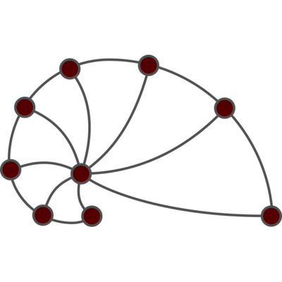
sp_baboons: Baboons' interactions (2020)
Network of interactions between a group of 20 Guinea baboons living in an enclosure of a Primate Center in France, between June 13th 2019 and July 10th 2019. The data set contains observational and wearable sensors data.
This network has 13 nodes and 63095 edges.
Tags: Social, Animal, Offline, Unweighted, Weighted, Temporal, Metadata
 @janneke@todon.nl
2026-02-09 18:27:30
Still hooked on BLUE. Hacked all day yesterday and today converting Dezyne's (https://dezyne.org) build system. Opened six issues, and two pull requests, one already merged.
It's not perfect *just* yet, in fact, some issues are show-stoppers for BLUE to replace Autotools for Dezyne, which has a pretty "…
 @Mediagazer@mstdn.social
2026-02-07 15:36:13
A look at the FOIA system, as right-wing media networks flood it with robo-requests, the number of FOIA agents stays flat, and states opt for higher fees (C.J. Robinson/Columbia Journalism Review)
https://www.cjr.org/tow_center/too-many-foia-requests-too-lit…

 @hex@kolektiva.social
2026-01-05 11:44:42
If you are an anti-fascist, you are against petroleum. Petroleum funds fascism globally. It is at the heart of the military industrial complex driving global imperialism, from both the US and Russia. Motonormitivity is fascist, both in it's elitist roots and in it's ties to historical fascism (Hitler hated bikes, just on principle). Oil is militarism.
Oil is the dominant resource which drives war, both in terms of it being the primary spoil wars are fought over and in terms of fueling the military vehicles and weapons that carry out those wars. Practically every war since (and including) WWII has been over oil. Genocides are carried out to secure oil. Gaza is over oil, in more ways than one.
Oil is the absolute enemy, and AI is simply an extension of that: an attempt to atomize us so we can't resist the oil-centric global order, one last grasp at the control over our lives oil has given to those whose power is now threatened by a solar punk future.
"I haven't written for a few weeks now. As I write the closing chapter and begin rewriting previous sections, everything feels both more distant and more immediate. The working title [Kairos] has only continued to feel more and more resonant, both during the writing and during my pause."
Now is the time to resist by making something different, by creating a world fundamentally opposed to these systems of oppression.
This is the last in my Kairos series. From here on out I'll be editing to try and make it more of a book than a series of posts. Thanks to everyone who has helped so far. All editing is welcome (typos, spell checks, questions and challenges). Between ADHD and dyslexia, it's always hard for my brain to notice mistakes in my own text so I always appreciate the support of those who can.
https://anarchoccultism.org/building-zion/kairos
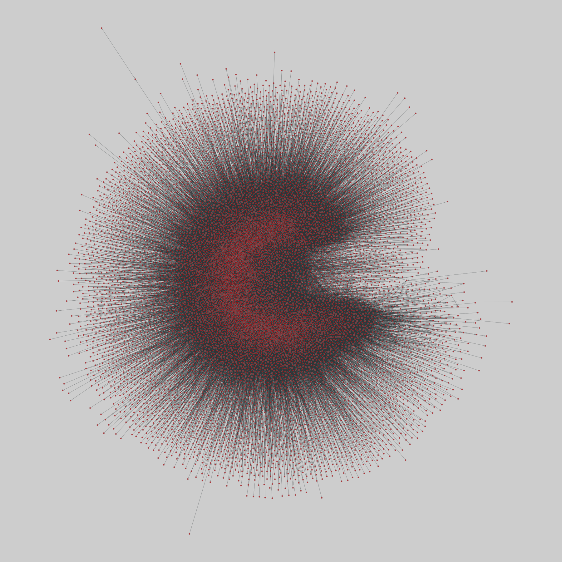
@netzschleuder@social.skewed.de2025-12-09 16:00:04
wiki_rfa: Wikipedia RfA voting network (2013)
The set of all votes on Requests for Adminships (RfA), from 2003 to May 2013, represented as a directed, signed network in which nodes represent Wikipedia members and edges represent votes.
This network has 11381 nodes and 198275 edges.
Tags: Social, Relationships, Signed
https://