 @edintone@mastodon.green
2025-11-26 22:02:41
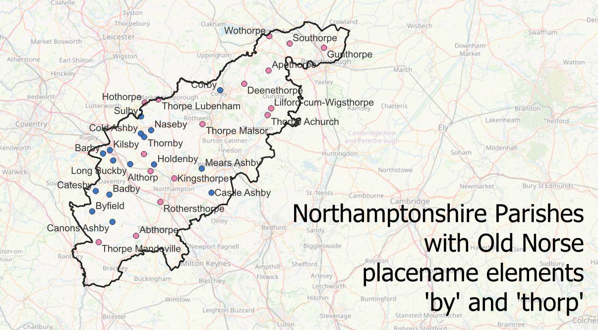
#30DayMapChallenge Day 24: Places and their names. Place name elements are always interesting (and fun) to map. Here the Old Norse 'by' and 'thorp' elements in #Norhamptonshire. Data from Digital Survey of English Place-Names