 @netzschleuder@social.skewed.de
2025-12-16 16:00:08
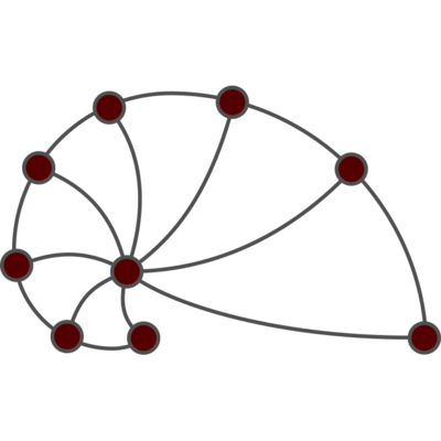
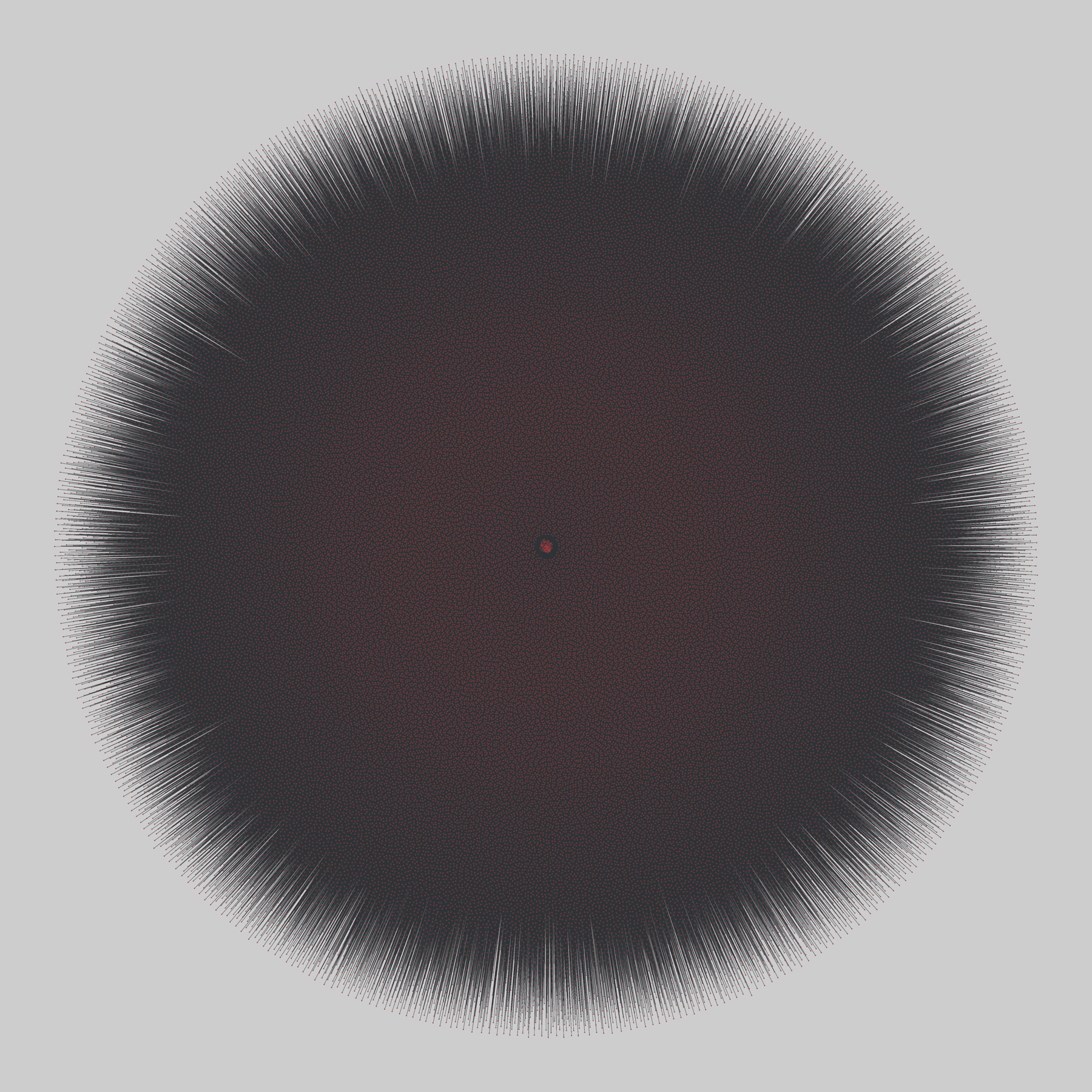
jester: Jester joke ratings (2001)
Two bipartite networks of users and jokes, extracted from the online joke recommender system Jester. A user connects to all jokes for which that user entered a rating. Edge weights give the rating score, scaled from -10 to 10. The two files differ by how many joke nodes are included, 100 or 150.
This network has 73521 nodes and 4136360 edges.
Tags: Economic, Preferences, Weighted

 @Mediagazer@mstdn.social
2025-10-17 18:11:05
India's JioStar reports gross revenue of $815M for the quarter ending September 30 and $149M profit after tax; JioHotstar averaged 400M monthly active users (Naman Ramachandran/Variety)
https://variety.com/2025/tv/news/jiostar-2-billion-…
 @netzschleuder@social.skewed.de
2025-10-15 03:00:07
jester: Jester joke ratings (2001)
Two bipartite networks of users and jokes, extracted from the online joke recommender system Jester. A user connects to all jokes for which that user entered a rating. Edge weights give the rating score, scaled from -10 to 10. The two files differ by how many joke nodes are included, 100 or 150.
This network has 73521 nodes and 4136360 edges.
Tags: Economic, Preferences, Weighted

 @steve@s.yelvington.com
2025-12-16 12:26:19
We have reached a stage where we have to turn to the jesters for truth.
From: @…
https://flipboard.com/@thenewsdesk/cel
 @raysofred@discordian.social
2025-10-15 15:45:06
posting this again because the JARten never ends #justarobot #ytp
 @ruth_mottram@fediscience.org
2025-12-11 16:56:52
Epic and also wildly fascinating thread on solar dynamics by @… ...
The good and hard science really is on mastodon.
https://social.sciences.re/@jaztrophysicist/115699880320576048
 @kexpmusicbot@mastodonapp.uk
2025-11-09 09:14:15
🇺🇦 #NowPlaying on KEXP's #SeekAndDestroy
Jack Starr:
🎵 Concrete Warrior
#JackStarr
https://jackstarr.bandcamp.com/track/concrete-warrior-remastered-feat-rhett-forrester
https://open.spotify.com/track/4IGnqFSpKfrOWVM65dzdEn
 @benthos@mastodon.sdf.org
2025-11-15 18:39:47
"Carmina Burana: Songs From The Original Manuscript" - Studio der Frühen Musik (1968)
#NowPlaying #StudioDerFruhenMusik #ThomasBinkley
 @netzschleuder@social.skewed.de
2025-12-10 20:00:07
jester: Jester joke ratings (2001)
Two bipartite networks of users and jokes, extracted from the online joke recommender system Jester. A user connects to all jokes for which that user entered a rating. Edge weights give the rating score, scaled from -10 to 10. The two files differ by how many joke nodes are included, 100 or 150.
This network has 73521 nodes and 4136360 edges.
Tags: Economic, Preferences, Weighted
 @netzschleuder@social.skewed.de
2025-12-09 11:00:07
jester: Jester joke ratings (2001)
Two bipartite networks of users and jokes, extracted from the online joke recommender system Jester. A user connects to all jokes for which that user entered a rating. Edge weights give the rating score, scaled from -10 to 10. The two files differ by how many joke nodes are included, 100 or 150.
This network has 73521 nodes and 4136360 edges.
Tags: Economic, Preferences, Weighted
