 @seav@en.osm.town
2026-03-21 04:12:28
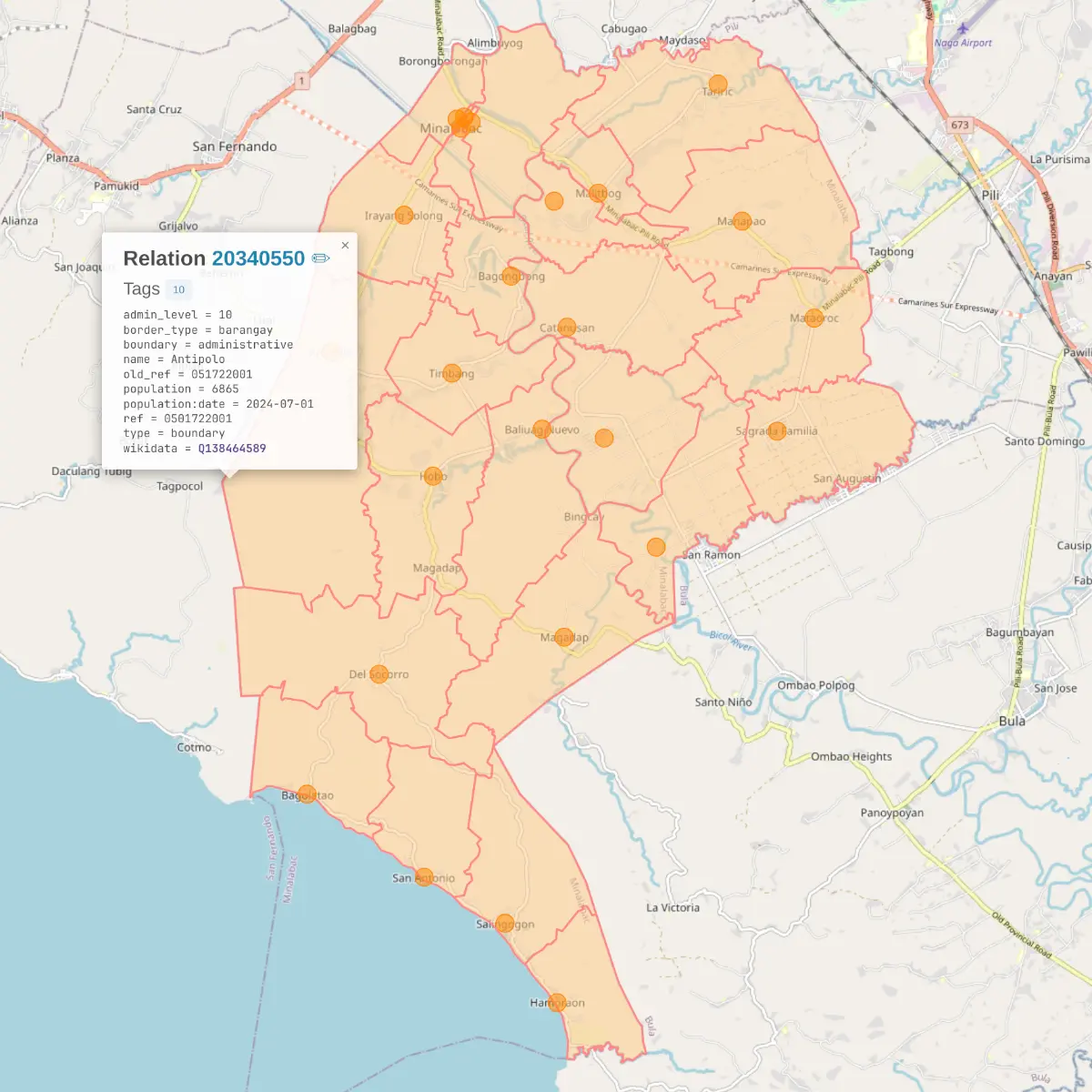
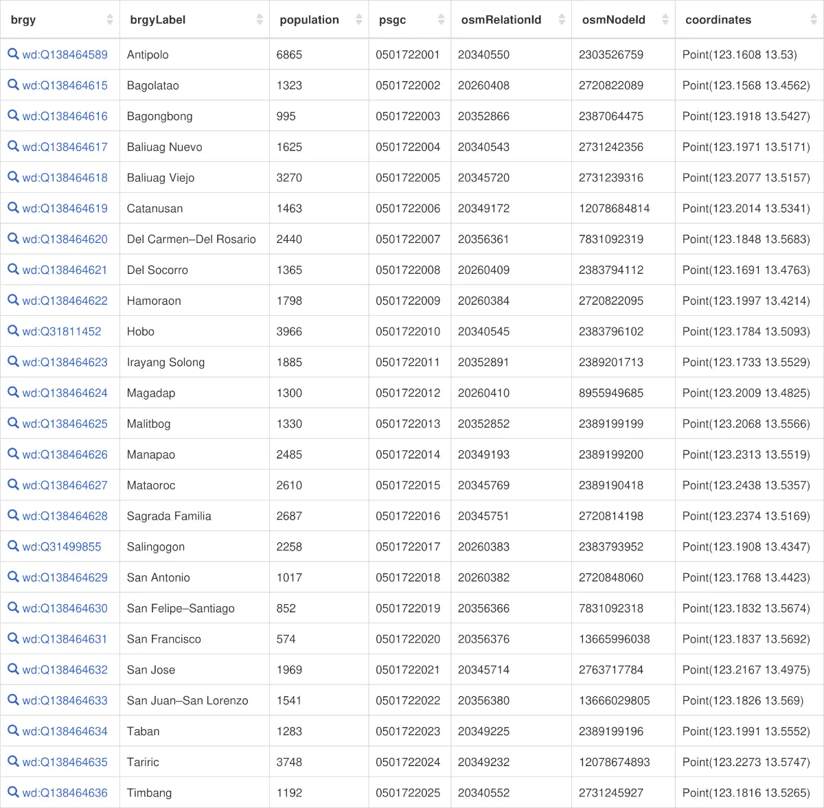
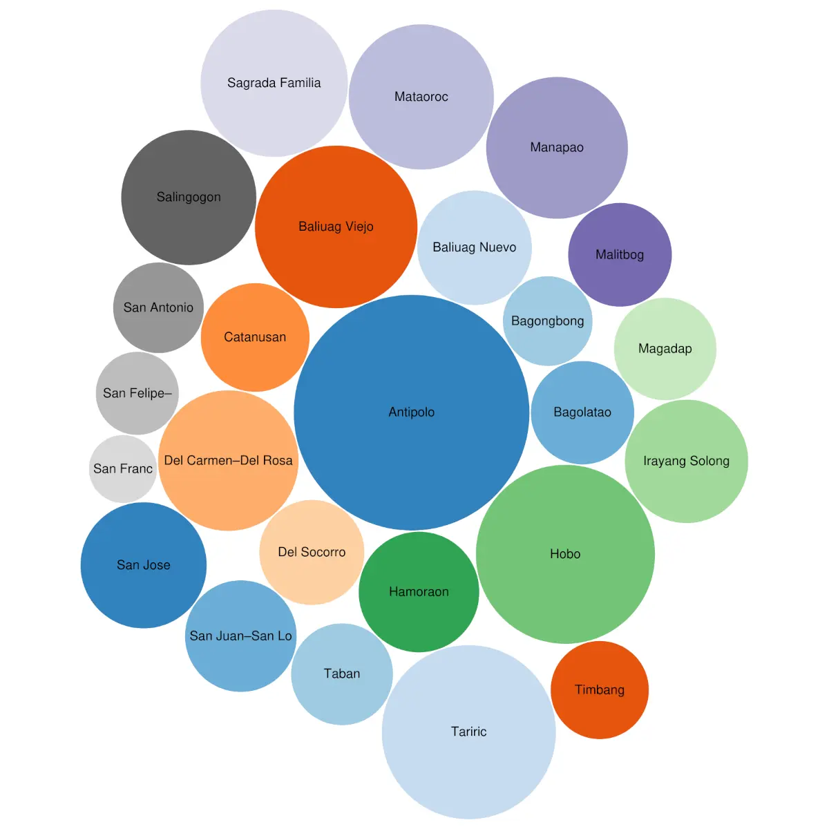
Done mapping all 25 #barangays of Minalabac, Camarines Sur, #Philippines 🇵🇭 in #OpenStreetMap, creating/updating their #Wikidata
 @seav@en.osm.town
Done mapping all 25 #barangays of Minalabac, Camarines Sur, #Philippines 🇵🇭 in #OpenStreetMap, creating/updating their #Wikidata