Tootfinder

Opt-in global Mastodon full text search. Join the index!

@hikingdude@mastodon.social
2026-06-27 09:25:15

I set the alarm to 6am and we started at 7am. My wife cycled a small morning loop (like 45min) and I did a bit larger loop to test the 30 tooth Sprocket on longer climbs.
*Learnings today:*
- mosquitos can be a real motivator to push harder
- the sprocket feels good
- the #garmin incident detection works
- 1st aid kit is a good investment
- good medical coverage in …
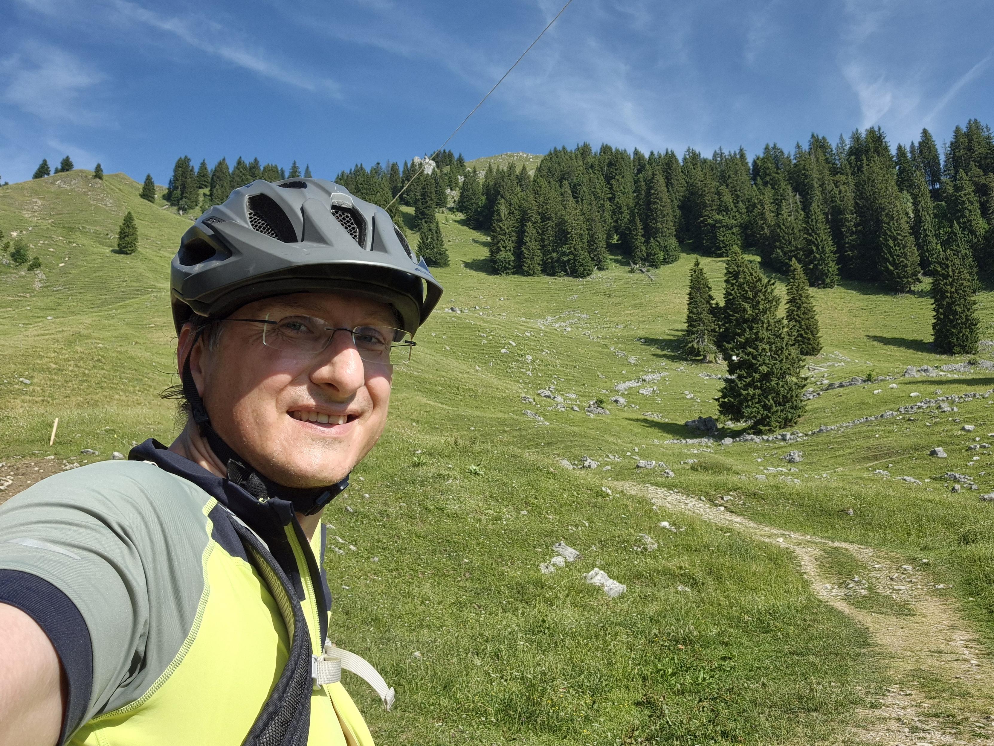
This image captures a joyful and scenic moment during a cycling or mountain biking adventure. In the foreground, a person is taking a selfie, wearing a black helmet, glasses, and a bright yellow and gray cycling jersey. The individual is smiling, reflecting the enjoyment and excitement of the ride.
The background reveals a stunning mountainous landscape with rolling green hills dotted with evergreen trees. A winding dirt trail cuts through the meadow, leading the eye deeper into the scene. The …
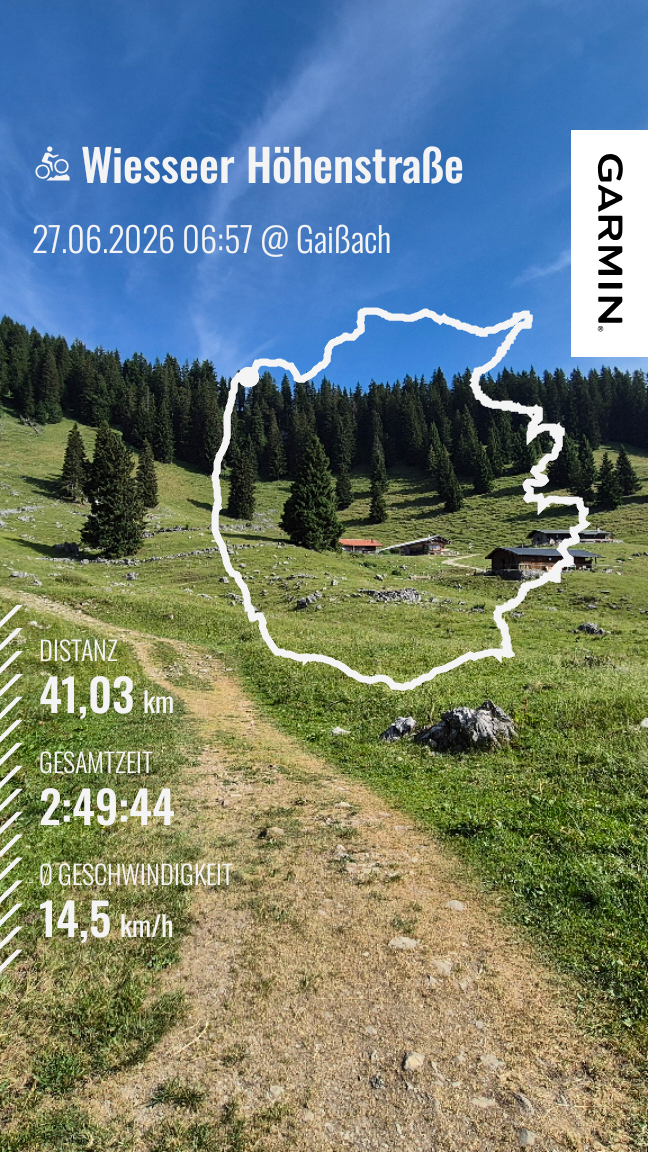
This image is a Garmin Connect summary of a cycling activity titled "Wiesseer Höhenstraße", completed on June 27, 2026, at 06:57 in Gaißach. Here are the key details of the ride:
- Distance: 41.03 kilometers
- Total Time: 2 hours, 49 minutes, and 44 seconds
- Average Speed: 14.5 km/h
The image features a scenic background of a lush, green mountainous landscape with dense forests and a winding trail. The route trace is overlaid on the image, showing the path taken during the ride. The Garmin log…
@hikingdude@mastodon.social
2026-05-08 20:43:08

The journey with my (likely) broken #Garmin Cycle computer continues:
I had some exchange with the Garmin support. They now open a ticket at the US-support ...
Meanwhile I saw a good offer for the successor model - and bought it. I don't believe mine will make it again. I guess I'll sell it - likely as defect (if it can't be fixed).
If garmin can get it back to live …

@phpmacher@sueden.social
2026-06-07 15:45:23

Ich habe ein #Garmin #Edge 520 und überlege, #OSM Karten zu nutzen
Wer hat Erfahrung damit?
Und welche sind zu empfehlen?
Velomap? Freizeitmap?

@hikingdude@mastodon.social
2026-05-01 18:28:45

This was a nice ride. Some sections involved pushing the bike. And some steep parts came a bit surprising. But overall it was nice with some quite challenging sections. It was a loop that I wanted to try since quite a while.
And it's a new elevation record since I own the Garmin 🎉
Just my #garmin now suddenly refuses to connect to my phone. 😵‍💫 Factory reset, all suggestions fro…

Here are the key details of the ride:

- **Distance:** 42.43 kilometers
- **Total Time:** 3 hours, 24 minutes, and 6 seconds
- **Average Speed:** 12.5 km/h
- **Total Ascent:** 1,052 meters
- **Average Heart Rate:** 147 beats per minute

The map trace shows the path taken, highlighting the shape and layout of the route. This appears to be a challenging ride with significant elevation gain. If you have any questions or need further analysis, feel free to ask!
A serene and rugged forest scene unfolds in this image, capturing the raw beauty of a mountainous trail. The foreground features a rocky, uneven path that winds its way through a dense woodland. The path is strewn with rocks, fallen leaves, and patches of moss, adding texture and a sense of natural wildness to the scene.

The trail is flanked by tall trees, their lush green foliage creating a natural canopy overhead. The trees add depth and a sense of peaceful solitude, their branches casting d…
@hikingdude@mastodon.social
2026-05-04 18:03:55

buhhhh - and my #Garmin disconnected again today after half an hour on the bike.
*sigh