2025-10-01 07:09:23
I just noticed that I need to scroll several continents to the left or right on the #fediverseobserver #map to find some nodes. Imagine needing to fly around the earth several times to land in their #timezones
Over the weekend I came close to joining these two sections of where I've ridden my bike! The square on the bottom is where the bike shop is where I got my new bike a month ago. Might be a project for next weekend.
#biking #bikeTooter
The street names in this part of Queens, New York City, seems deliberately confusing. 🤨🗺️
(Map © #OpenStreetMap contributors, ODbL 1.0)
#NYC #NewYorkCity
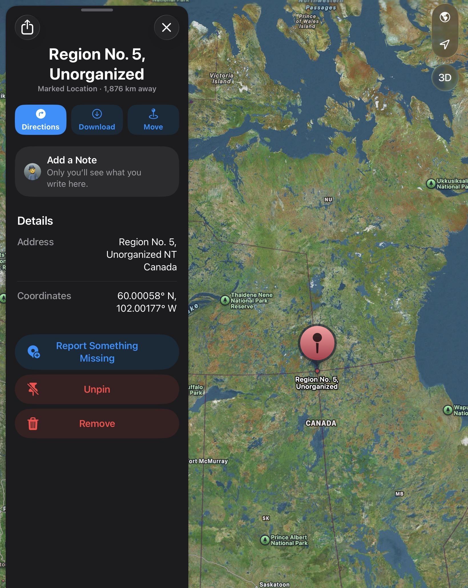
huh. TIL: there is a “four corners” place in Canada, like there is more famously in the USA, where Utah, Colorado, Arizona and New Mexico meet.
But ours is automatically cooler, figuratively and literally*, because it is a: at 60° Latitude, and b: involves two Territories and two Provinces.
It is where the Northwest Territories, Nunavut, Saskatchewan, and Manitoba meet.
It is also a LOT harder to get to. Though arguably, as it is amongst the thousands of lakes in the area, during the summer, a float plane would get you there.
Also, technically. It is not a perfect “joining” on the map which is just bad planning on Canada’s part, but at least it is hiking distance. Or that might be just a projection issue. They seem to converge at 60N 102W. I guess I could consult an official boundary document or something :)
Apple Map location: #agw not withstanding
#geography #uselessKnowledge #nerd #maps #canada #sk #mb #nwt #yt #climatechange
🇺🇦 #NowPlaying on KEXP's #DriveTime
Map of Africa:
🎵 Bone
#MapofAfrica
https://latenighttales.bandcamp.com/track/bone
https://open.spotify.com/track/0JnzTTr0uUQHsQaAA2XOVe
#DearFedi, does anyone happen to know a website or an app that I could use to easily highlight (as in using color) selected parts of the #railway network (ideally by choosing two stations to get everything in between highlighted), so I could mark which parts of the network I've already traversed, and then share it with you? (needs to include Polish railways)
#rail #map #OpenStreetMap #OpenRailwayMap