 @davej@dice.camp
2026-05-22 16:51:32
@davej@dice.camp @ncoca@social.coop
 @kexpmusicbot@mastodonapp.uk
🇺🇦 #NowPlaying on KEXP's #MorningShow
Maps:
🎵 To the Sky
#Maps
https://open.spotify.com/track/2HmDCa6XLhz5ZCx3G1Svxy
 @toxi@mastodon.thi.ng
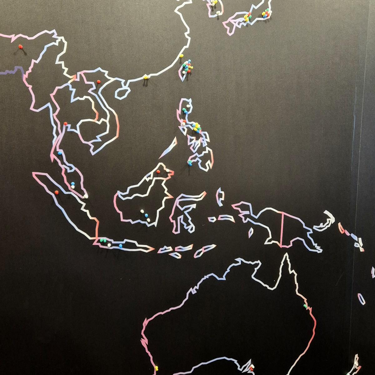
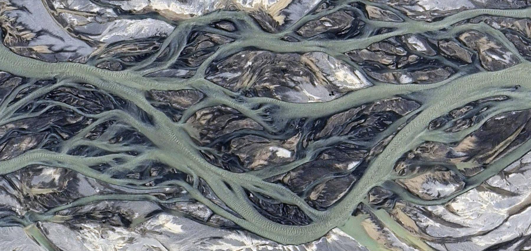
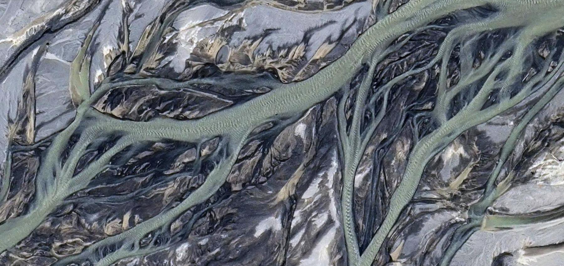
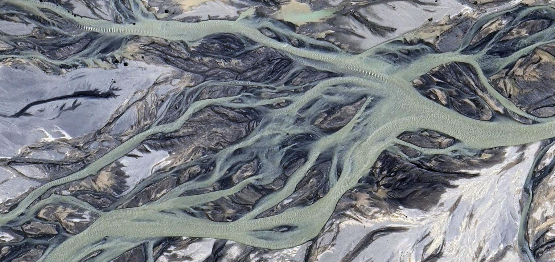
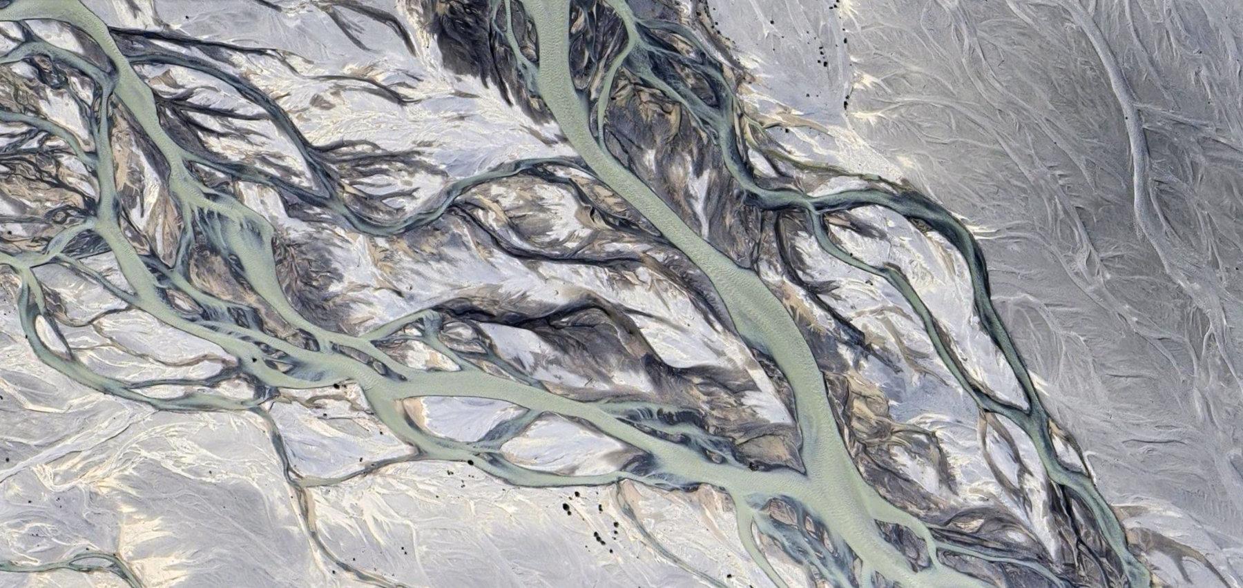
Some #MapSurfing for #TextureTuesday... This time assorted satellite images from Katmai National Park in Alaska, specifically the delta at Iliuk Arm Naknek Lake (continuation of the Valley of 10000 Smokes)
 @lpryszcz@genomic.social
 @seav@en.osm.town @seav@en.osm.town @kexpmusicbot@mastodonapp.uk
🇺🇦 #NowPlaying on KEXP's #VarietyMix
Maps & Atlases:
🎵 Old Ash
#Maps #Atlases
https://mapsatlases.bandcamp.com/track/old-ash
https://open.spotify.com/track/7jiT1kpzAREkTpCEzjqAam