 @chrysn@chaos.social
2026-03-01 14:57:55
Trying to understand recent #RustLang activities (https://github.com/rust-lang/compiler-team/issues/922), why do types with uninhabited fields (or enum variants that are uninhabited) ta…

 @StephenRees@mas.to
2026-03-29 19:17:23
From TransLink
Westham Island Bridge reopens following successful repair work
Access restored to Westham Island after temporary closure caused by marine vessel strike
Some critical repair work will continue in the coming weeks to stabilize piles with rock protection, remove the temporary pier, and add more steel reinforcements. The navigation channel remains closed to marine traffic while this is an active construction site.
1/2

 @inthehands@hachyderm.io
2026-02-26 05:19:20
While staying vigilant, we’re embracing the chance to catch our breath and to start healing. The city right now has a bit of the feeling of the days after a natural disaster: there is so much damage to repair. Thousands of people are still sheltering at home, understandably reluctant to go to work and/or school. Thousands are facing imminent eviction when March rent comes due.
There’s organizing around rent relief, talk of a rent strike. Food delivery is still in full swing. Mutual aid is not letting up.
9/
 @Erikmitk@mastodon.gamedev.place
2026-03-31 19:04:00
Happy Birthday, Angus Young!
I listen to Live At River Plate almost every day. This album and his performance all across the board gives me life!
When I’m 71 I want to be able to jump and run around as much as he still does!

 @kurtsh@mastodon.social
2026-03-17 05:16:00
Attention Browncoats: SHARE THIS VIDEO.
As Nathan says, they need the viewing metrics to push the Firefly animated series forward!
https://www.instagram.com/reel/DV6Js56jT3F/?igsh=MTc4MmM1YmI2Ng==

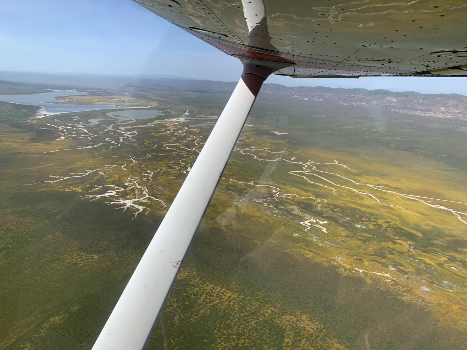
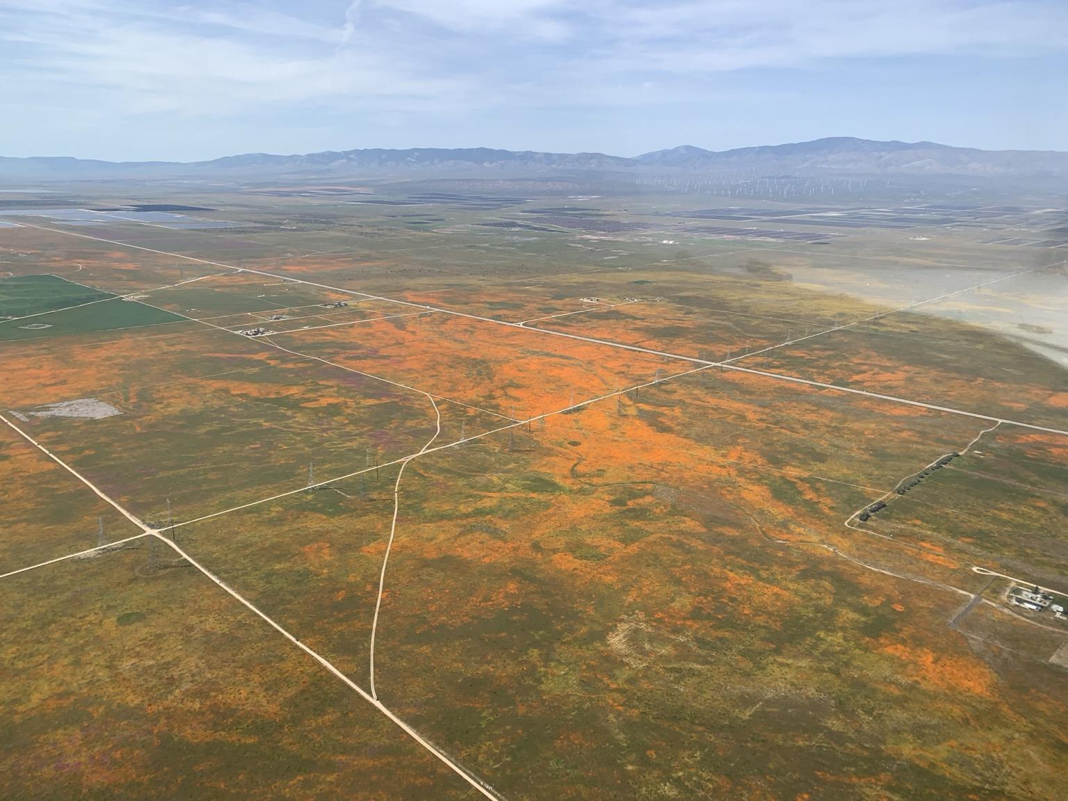
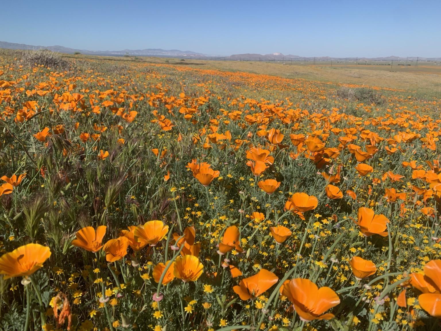
 @cosmicray@mastodon.social
2026-03-22 04:40:43
Aerial scouting was an effective, and very scenic, way to find the most intense #wildflower blooms in the Carrizo Plain and Antelope Valley
#flying

 @Dragofix@veganism.social
2026-02-20 22:45:26
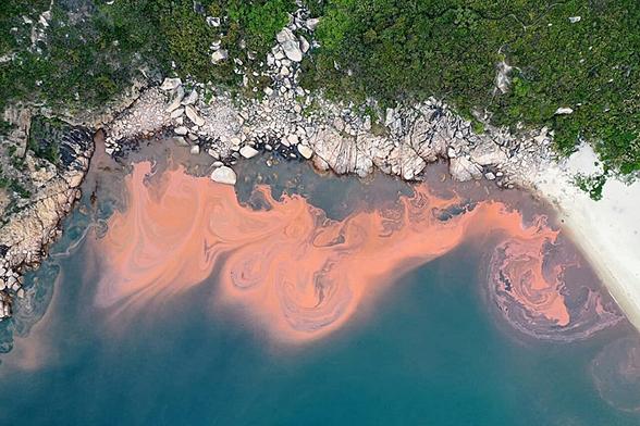
Extreme rainfall is worsening algal blooms along South Korea's coast #SouthKorea
 @StephenRees@mas.to
2026-01-27 23:31:55
From Translink
Westham Island Bridge Repair Update
🧵1/9
TransLink is moving urgently to restore the Westham Island Bridge following a marine vessel strike on January 20. Engineering inspections have confirmed significant structural damage and, while repairs are complex, work is starting to minimize disruptions and safely reopen the bridge to vehicles as soon as possible.
Detailed inspections show that Pier 5, one of the bridge’s primary support structures, was severely…
@Erikmitk@mastodon.gamedev.place2026-01-19 21:48:20
„It’s a path puzzle. You draw a path that enters the grid at the top and exits at the bottom. Along the way, there are 50 sections, each following a different ruleset. Consecutive sections overlap by a few rows, creating short hybrid sections in between.”
This is amazing! The printable PDF-version is 17 pages! 🤯
https://
@StephenRees@mas.to2026-01-23 17:20:08
From Translink
Westham Island Bridge Repair Update
January 22, 2026
Delta, BC – Earlier this week, a marine vessel hit the Westham Island Bridge, causing damage that required the bridge to be closed to vehicle traffic. TransLink owns and maintains the bridge, and crews moved quickly to assess the damage and pursue the fastest possible repair.
TransLink has now received an updated assessment from our structural engineer following today’s inspection work.