 @floheinstein@chaos.social
2025-12-24 10:32:36
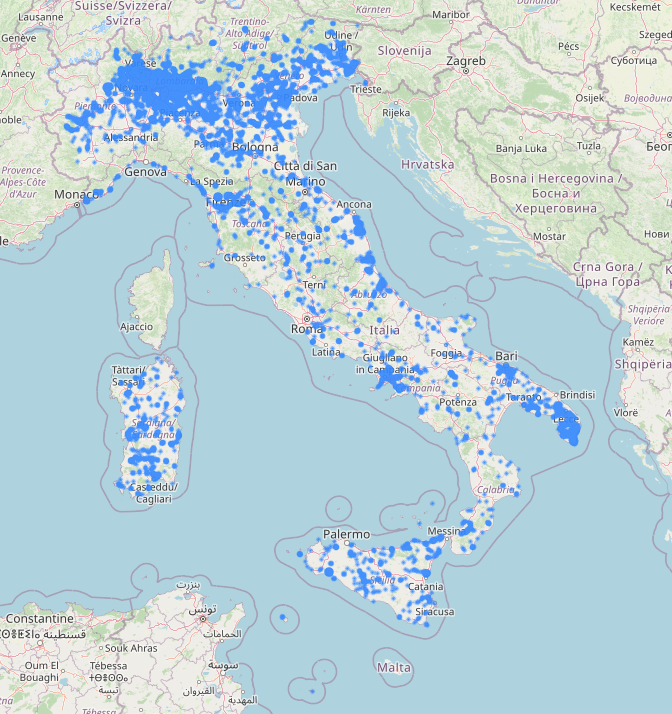
Ich habe grad etwas Schräges auf OpenStreetmap entdeckt: "Adliswilische Selbstständige Republik".
Ich seh sie nur bei einem gewissen Zoom und finde sie nicht bei der Suche
https://www.openstreetmap.org/#map=10/47.3094/8.5440
Weiss jemand was darüber?
…


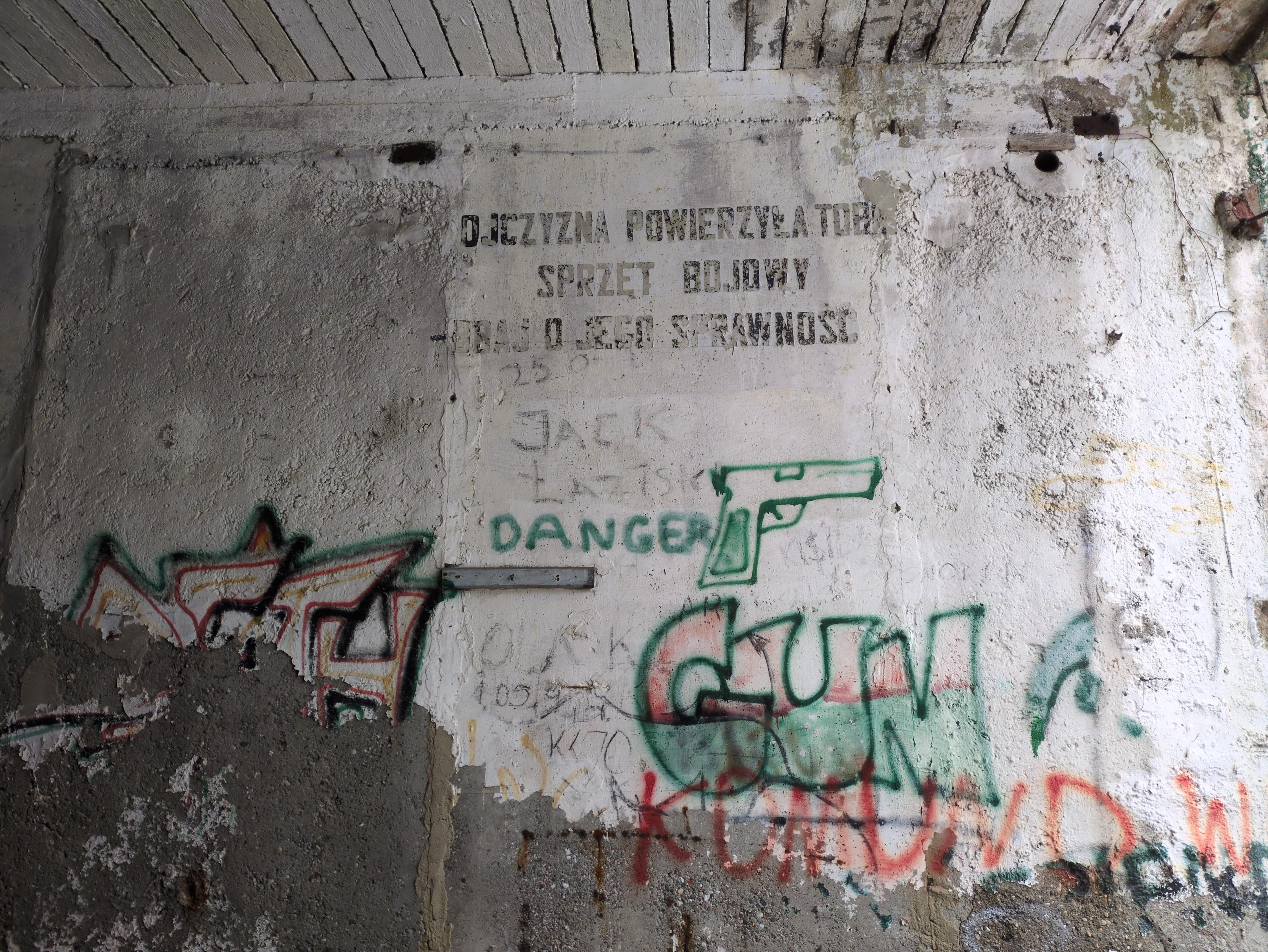
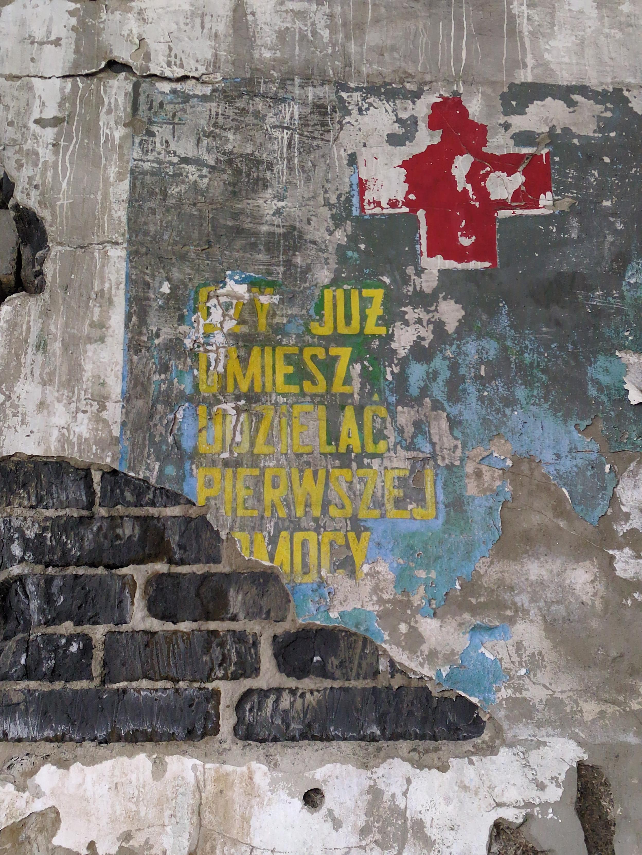
![Częściowo uszkodzona instrukcja, namalowana na ścianie obok otworu drzwiowego. Część ściany po prawej stronie otworu została odłupana, uszkadzając napis. U góry został przerwany również, kiedy ze ściany wyrywano przewody.
W miarę możliwości rekonstruuję go do:
"""
Uwaga
Przed wejściem do obiektu z atmosfery skażonej zapoznaj się z instrukcją wchodzenia do obiektu: Uzyskać zezwolenie wejścia do [obiektu?]. Przejście jest dozwolone tylko przy wygaszonym świetle stop. Wykonaj podane czynności w p…](https://pol.social/system/media_attachments/files/115/797/822/864/963/169/original/a58476564afb96fe.jpg)